
A Trip up the Temash
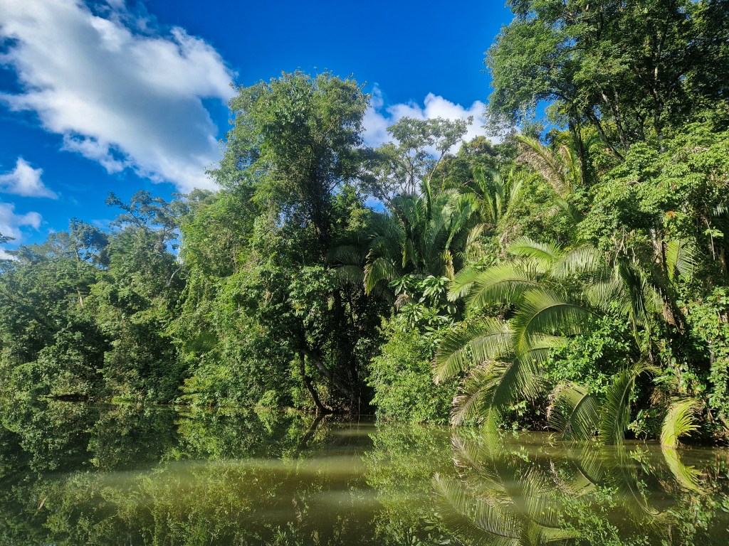
Very little is written about the Temash river of southern Belize, or the communities that lie along its banks. Even the language from which the name derives seems unknown, much less its meaning. The river’s source is loosely traced to the highlands of eastern Guatemala, whilst its mouth opens to a similarly unvisited stretch of Caribbean coast. The only ecological assessment, conducted in 2003, relied heavily on satellite imagery to map the river’s ecosystems and openly acknowledged the need for a more comprehensive report. Who lived in this area, if anyone, prior to the modern-day villages is hinted at only by fleeting reference in the grey literature to vague locations of archaeological sites unverified by formal field study. Much of what is written is misleading, fragmentary or simply false. With our curiosity inspired, we planned our visit to this mysterious landscape, our trip up the Temash.
Rain.
An unbroken wall of grey stretched out to the horizon from Punta Gorda. But beneath, a silver lining; the Caribbean gently rolled out before us, like silk but for the raindrop ripples, signalling our journey could begin.
The weather didn’t relent for the rest of the day, but with fresh arms and high spirits we made good time, covering some eleven miles southwards to the village of Barranco. The first indication that the village lay in the distance, before our eyes could make out the structures of the settlement, was a bank of red earth that sat stark against the surrounding green forest. It is for this ‘red bank’ that Barranco is said to take its name, and it is understandable when viewed from afar that this striking feature had impressed itself upon the the early inhabitants and their visitors. As we drew closer to the bank we saw the village beyond, half-hidden by palms and low cloud, a scatter of colour muted by the weather. Just before noon, we pulled our canoe to shore at the base of a large jetty protruding into the shallow bay of Barranco, ascended a short slope, and entered the village.
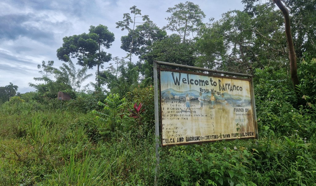
It was perhaps unsurprising, given that it was boxing day, that the village seemed deserted. Although, Barranco seems, at any time, a naturally relaxed place; not only do the the people have this aire, but from the shoals of sprat that float beneath the jetty, to the trio of aracaris perched contentedly in a tree next to where we slept, a presence of quiet harmony pervades the place. It took little time for us to explore the entire community; laid out on a simple grid of dirt roads, Barranco takes the form of a small square, home to around 160 people living in tin-roofed concrete houses, shuttered now against the weather.
Barranco is a Garifuna village. The origin story of this people is set on the Caribbean island of St. Vincent, and it is a unique and fascinating one. The Garifuna people are descended from those who had escaped slavery – in some accounts, stranded by a single shipwreck, though in others a more gradual process is assumed, as escaped slaves from over the region sought refuge on the island. Whatever the truth of the story’s beginning, these people co-habited the island with Indigenous Caribbeans, eventually becoming a unified people.
The result of this combination is the vibrant culture of the Garifuna. Whilst it is said that elements of religion, such as ancestor-based ceremonies, are characteristic of African forebears, the language is most clearly related to those indigenous to the island region preceding European contact. Whatever the origin of the cultural parts, the current whole is expressed as the joy and creativity that one finds in any Garifuna settlement of southern Belize.
The settlement of Barranco comes later in the story, although the precise date is unknown. In likelihood, it was used as a regular camp for transient populations using the sea as the Garifuna spread westwards, before it was established and enters records in the 19th century. In other areas of the country, the coastal location of Garifuna settlements has made way for new opportunities and challenges with the integration of the tourism industry. But Barranco has always been more remote, and the people here primarily practice farming and fishing as might those original inhabitants. Far from insular, though, the people of Barranco migrate often for economic opportunities or travel, returning periodically to their family lots, visiting relatives in a community in which the theme of kinship is strong. This strength feels almost tangible in the character of Barranco, a kind of welcoming presence that extends beyond those who call it home. It is this community strength, also, that has been necessary to affirm the livelihoods of the residents throughout the years, when various colonial administrations sought to privatise their lots and lands, and to prohibit their customary use.
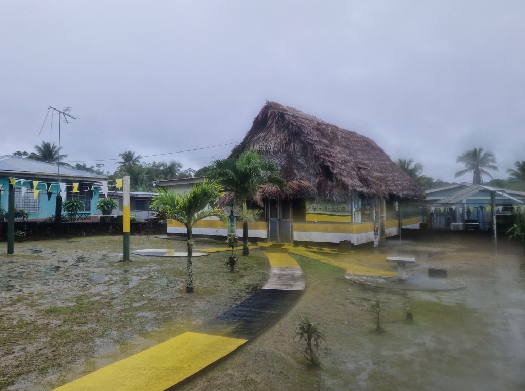
One of the most striking buildings in Barranco, decked in the vivid yellow, black, and white of the Garifuna flag, the Watina bar is as much a celebration of a rich cultural heritage as it is a local watering hole. From the ceiling hung traditional Garifuna apparel, photographs of notable locals and historical figures lined the walls, and above us a traditional dugout canoe rested on the rafters beneath the palm thatched roof. The most poignant display was that dedicated to the late Andy Palacio, after whose final album the bar was named. The landlord was keen to discuss Palacio and his legacy, having grown up alongside him in Barranco, and spoke of the Garifuna icon with both fondness and reverence.
When we returned to Watina on a later trip, the bar was animated by drumming. The musicians had come not only from Belize, but also from Guatemala and Honduras. Rhythmic, percussive chanting of the Garifuna language blended seamlessly with the drums, whilst dancers of all ages moved instinctively to the music. But on our first visit, the drumming drifted out from homes, played simply for the performer’s own enjoyment.
As we launched our canoe back into the bay of Barranco, some residual clouds lingered in the distance, but the weather held more promise than the day before. The sea was calm, and the couple of miles to the mouth of the Temash passed quickly as the day began to warm. Approaching the river, we noted a small cluster of cabins nestled amongst the trees on the north bank, though we gave them little thought at the time. Our attention was drawn instead to the southern vista; an unbroken sweep of mangrove curving away towards Guatemala in the distance. At its extent rose the foothills of the mountains, hazy and mysterious, the morning sun yet to burn through the mist clinging to their slopes. From the low vantage point of the canoe, they felt especially vast, rising magnificently into the dawn. Yet for all of their intrigue, they lay beyond our course. Our route turned west, into the mouth of the Temash, and away from the open sea.
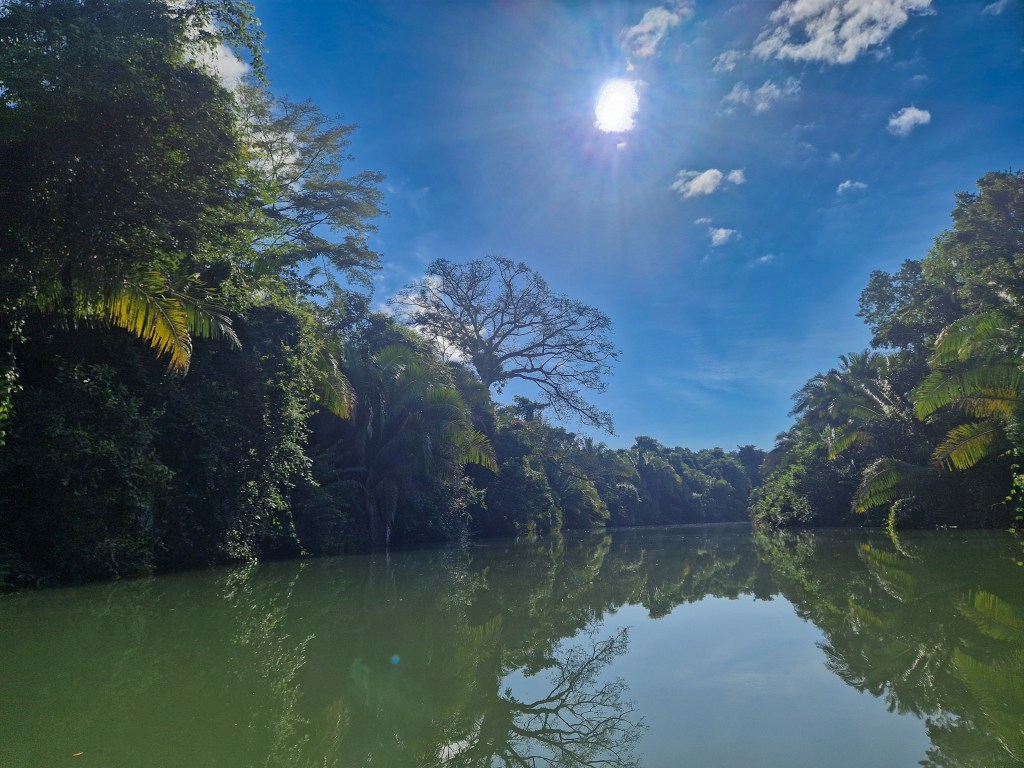
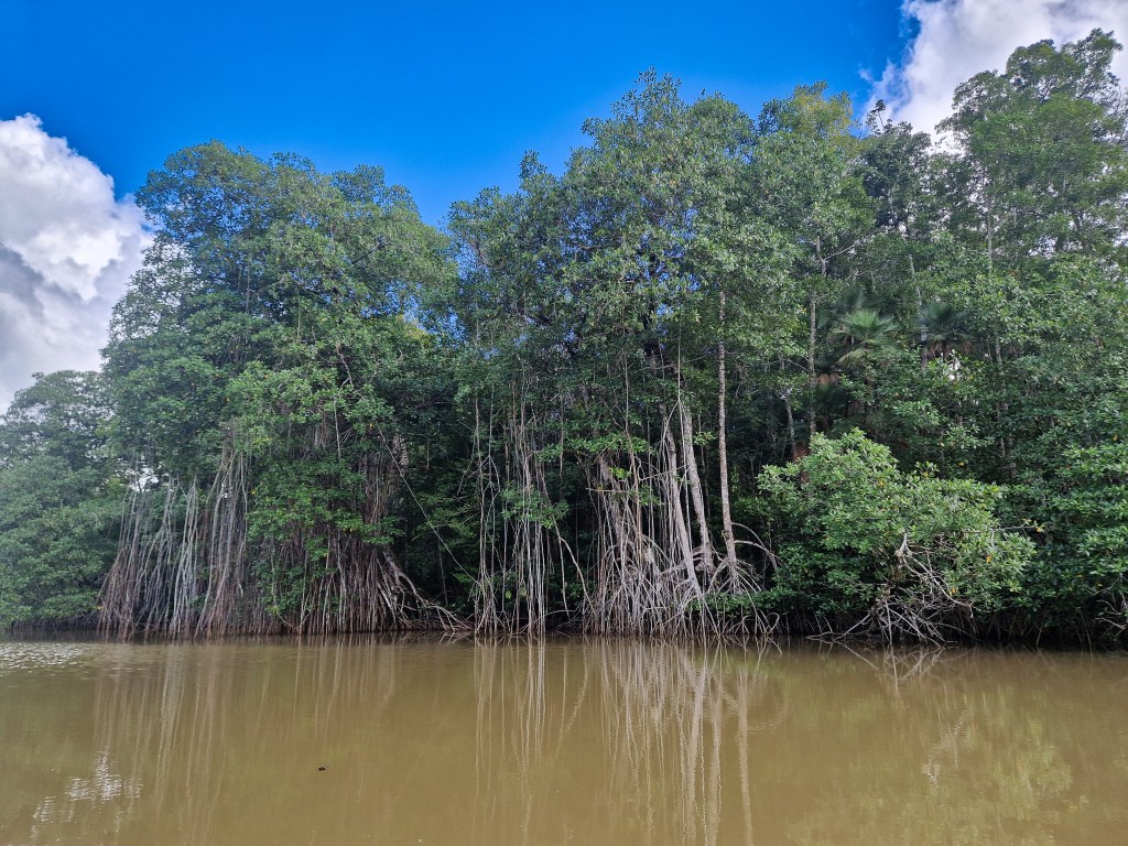
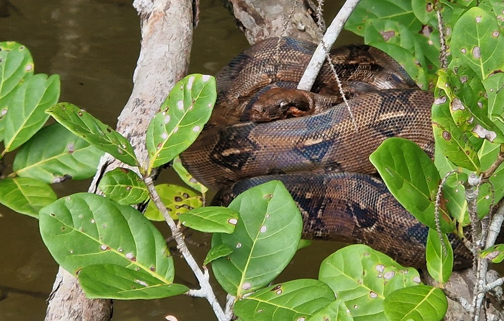
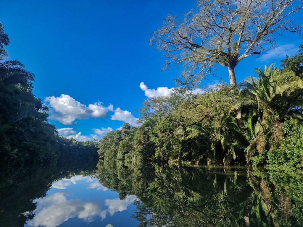
A slow-moving tea-coloured river winds its way through the landscape, its brown water heavy with sediment. The surface is smooth and reflective, broken only by drifting leaves and branches. On either side, dense mangroves crowd the banks, their tangled roots arching into the water like grasping fingers, half-submerged and slick with mud. The dense green was broken by occasional flash of colour as a bird or butterfly caught our eye. We rowed peacefully upstream for several hours, the sun climbing steadily overhead, and casting shifting patterns of light across the water as the river meandered. Our progress was only interrupted by the site of a heron gliding low across the water in front of us, a family of Coatis dancing along branches, their tails held high for balance, and a Boa Constrictor coiled on a mangrove root at the water’s edge, perfectly still as it watched us in return. It was surprisingly quiet, the usual calls of birds muffled by the dense vegetation all around us, and in places the river seemed enclosed and secretive, shaded by the mangroves’ deep green canopy, the water turning dark brown and the air thick and humid with the sulphuric smell of decomposing vegetation. Then the channel would open out into dazzling sunlight, the reflections of white clouds adorning the water, and a welcome fresh breeze would stir.
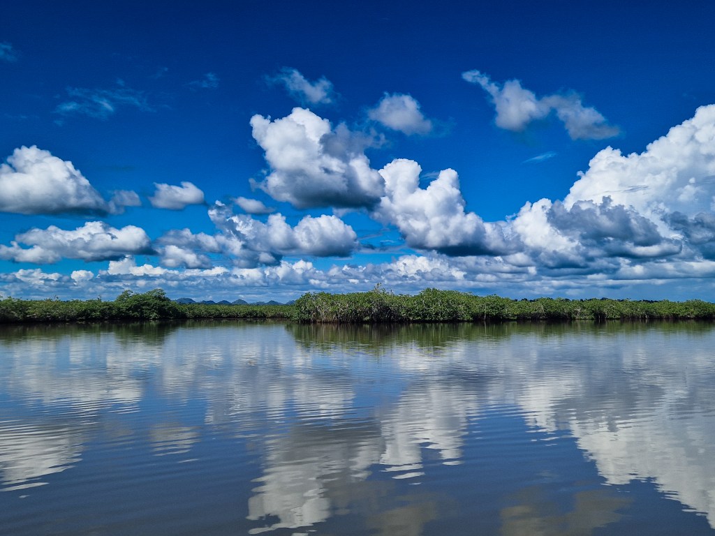
Ahead, the river widened into a broad lagoon. The water lay perfectly still, a flawless mirror of the sky above and the green mangroves that lined either side. Small islands of tangled roots dotted the surface and narrow streams branched off invitingly in every direction, forming a chaotic winding maze of waterways. Beyond, the Maya Mountains rose in the distance, softened by heat haze, their shapes offering some perspective to the land behind the flat wetland.
As the morning slipped into afternoon, we began to discuss where we should camp for the night. Our research suggested that, about two thirds of the way up the river, the mangroves would briefly give way to forest, hopefully offering more suitable trees to hang our hammocks from, and a sturdier base than the latticed roots of the lower river. However, as we approached the promised point – and then drifted beyond it – the banks seemed as impenetrable as ever. Spotting an opening, we pulled the canoe in and hauled ourselves onto the bank. Foul smelling swamp underfoot, the relentless hum of mosquitos in the air, and dense forest pressing in on all sides made spending the night an uninviting prospect.
Checking the time, we decided to strike out for Crique Sarco, the settlement some further 12 miles upstream. It was just possible, at our current pace, before the loss of last light. The colour began to seep from the sky, and the forest around us seemed to stir. Birds swooped overhead looking for a place to roost, bats fluttered, and flashes of orange as outlines of iguanas tumbled from the branches above, mistaking us for predators and making an ungainly escape to the safety of the river below.
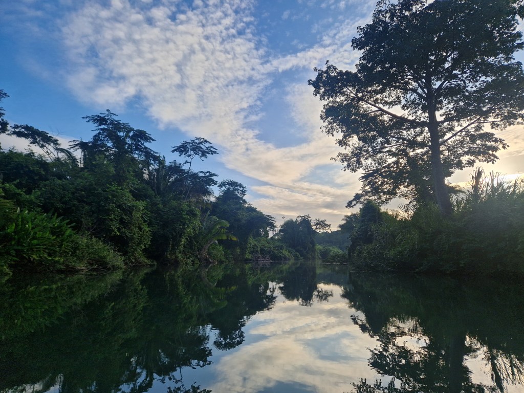
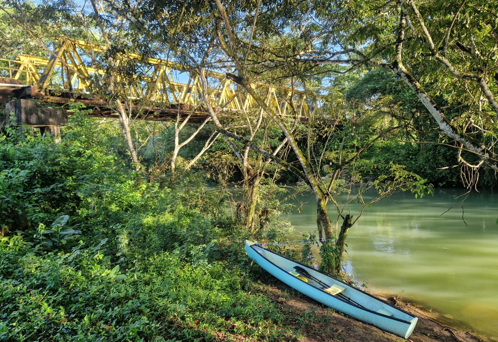
We had not anticipated the strengthening current as we neared the village. The canoe twisted, tugged sideways by unseen eddies, while each stroke became a battle to keep it on course. The river ahead of us blurred into shadow, colours flattening into dark greens and browns. Above the river a shape began to emerge from the darkness, but only when we were a couple of boat lengths away could we discern the much-anticipated silhouette of a bridge. The marker that Crique Sarco- and the end of our days row- was within reach.
The history of Crique Sarco – as with its neighbouring communities – begins long before its foundation. It is a Q’eqchi’ village, and understanding its establishment is rooted in the history of this indigenous people. The Q’eqchi’ originated in the mountains of what is now Alta Verapaz, Guatemala, although other Maya peoples – the Manche Ch’ol – lived in Toledo at that time. The arrival of colonial powers in Belize erased the Manche Ch’ol language from history and resettled many of its speakers in Guatemala, where some were absorbed into Q’eqchi’ communities; but renewed colonial oppression in Guatemala saw many Q’eqchi’ peoples move back into the sparsely populated Belizean lowlands to establish the communities known today. This history is important, because saying a village was established only within the past hundred years or so strikes a contrast with the concept of indigeneity we are used to.Crique Sarco emerged as one of the first of these recent villages in the early 20th century; but one cannot help but feel an antiquity there, that sense of quiet establishment more commonly felt in the ancient villages of Britain. Perhaps this can be accredited to retention of indigenous connection to the landscape, which authors have often viewed as the defence against cultural erosion, through the continuation of traditional farming methods and use of forest resources entwined into everyday life.
We had spent the night at the house of a friend. Exhausted from the exertion of the day, our clothes damp and heavy with river water, we approached the fire-lit doorway; our identities obscured by darkness, only haltering, English-accented Q’eqchi’ heralded our appearance. A single moment of surprise was afforded before we were enveloped in the welcome of a Q’eqchi’ home; we were warmed, fed, and shown to our bed within the hour.
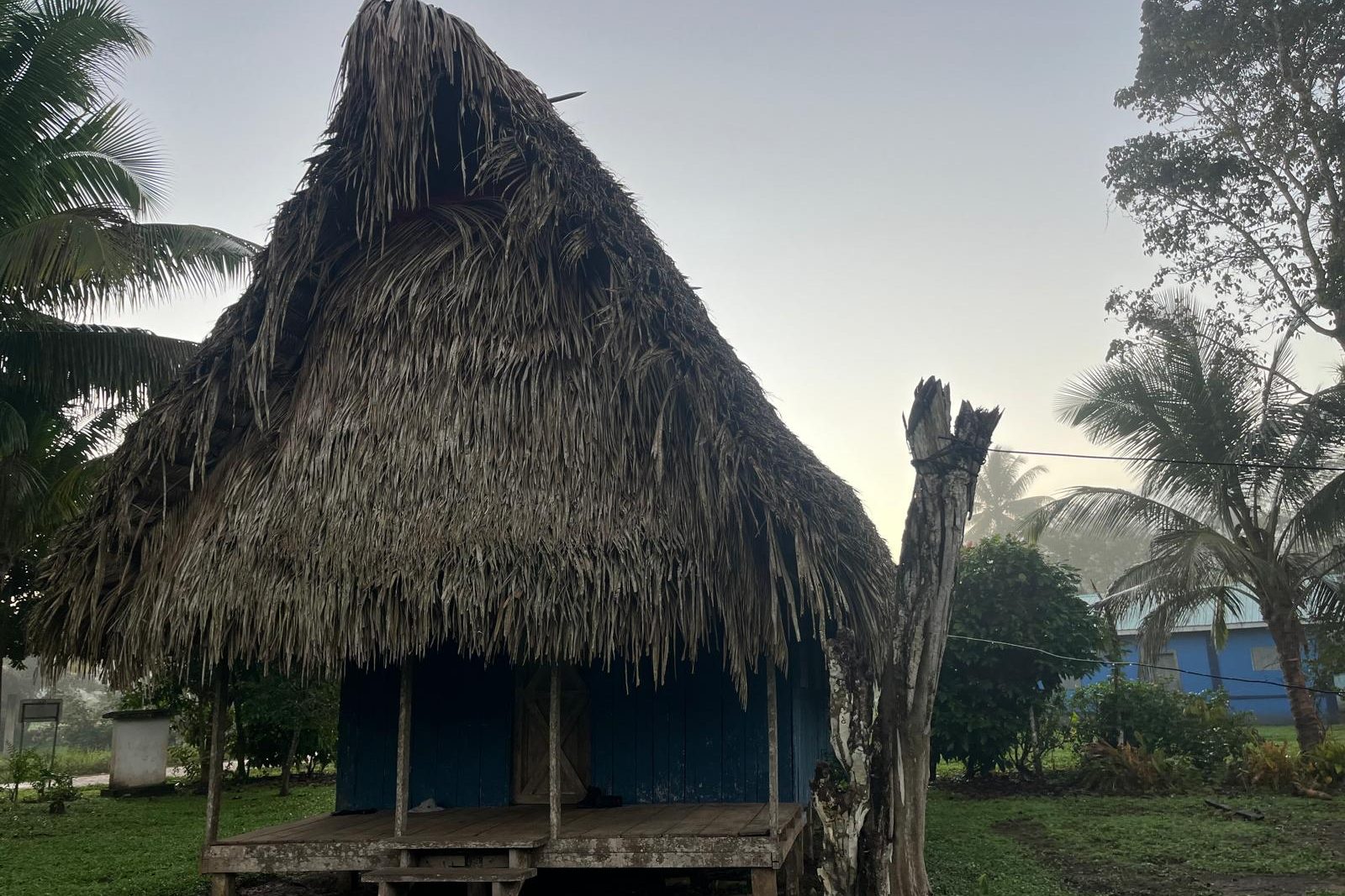
Focussed along the southern edge of the river, the village is comprised of thatch-and-plank houses laid out in no apparent pattern, as if they had tumbled like dice and come to rest in place. A village centre is discernible, boasting a football field with a wooden goalpost at each end, a cement-built two-story school, and an adjacent community centre. A small shop sells goods obtained from town. Tracks branch out from here, leading to clusters of the picturesque homes, interspersed with fruit trees and flowers, and dotted with the domestic dogs, chickens, and pigs that bustle and brawl freely throughout the village. These animals are the constant soundtrack to Crique Sarco, their calls carried from the distance along a gentle breeze, bestowing the surrounds with a quality of rural intimacy. The school bus rattles along the road daily from a nearby village, farmers leave early to attend their fields, and the women care for the home, their efforts sending smoke curling from the dry palm roofs three times a day.
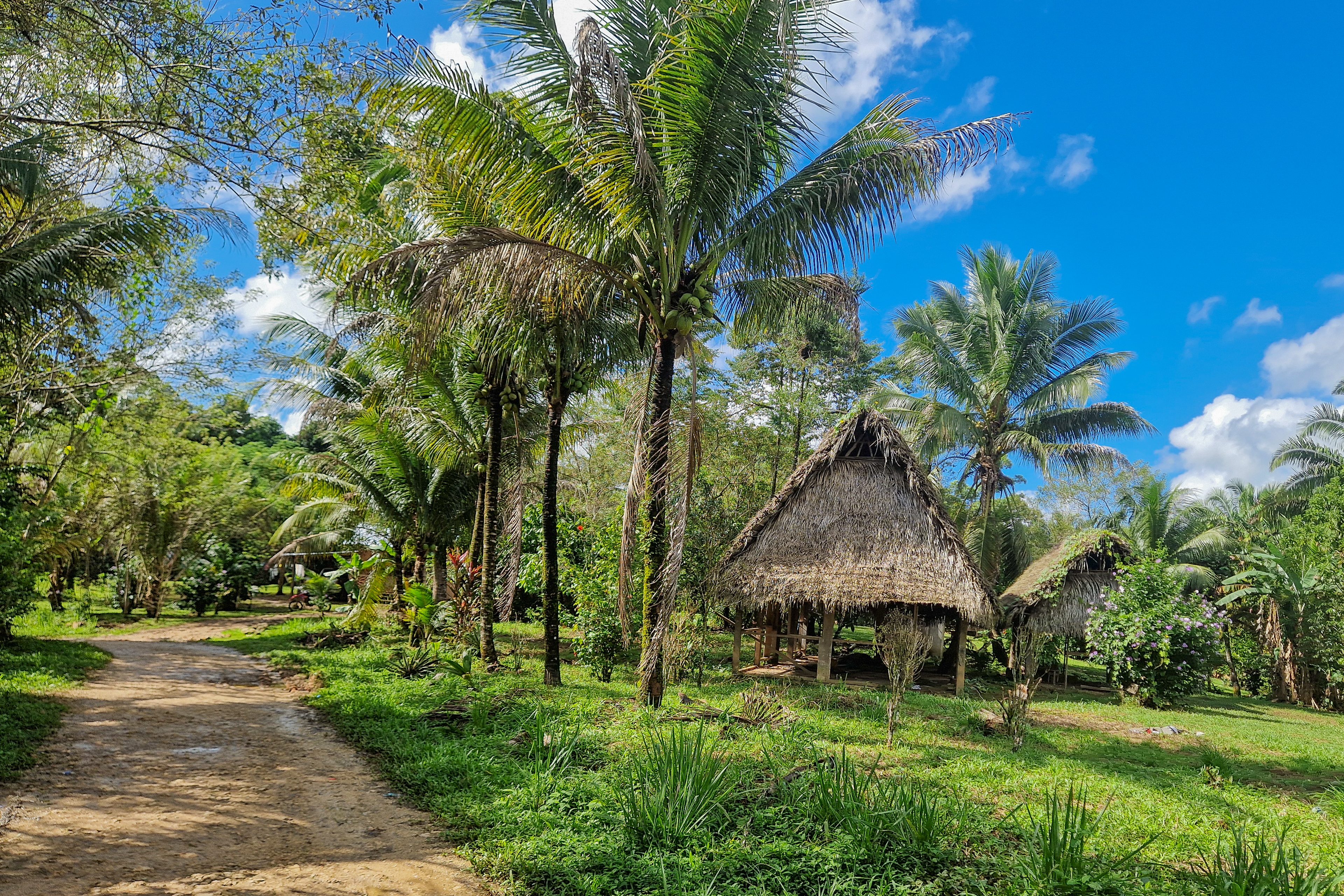
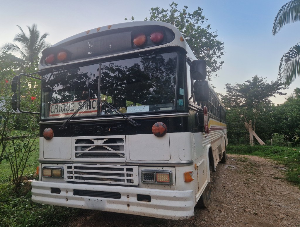
This imagery often evokes a paradisaical picture. It is hard not to see this as the way a village, any village, really ought to be. When asked, many villagers agree; but what is easy to overlook is the persistence, resistance, and negotiation required to maintain it. Just as Barranco, Crique Sarco has survived waves of external pressures, exploitation, and the encroachment of policies that would distort the picture as it now is. And life there can be difficult, without easy access to education, healthcare, or work, and with severe temperatures and floods increasingly affecting the crops that the community relies on. But the people continue to defend their village, because they recognise the beauty of its character and the way of life it provides.
We spent two nights immersed in the serenity of the village, watching daily life unfold. Then, in dawn’s pale light, we returned to the river, loaded our canoe, and were ready to embark on our journey downstream.
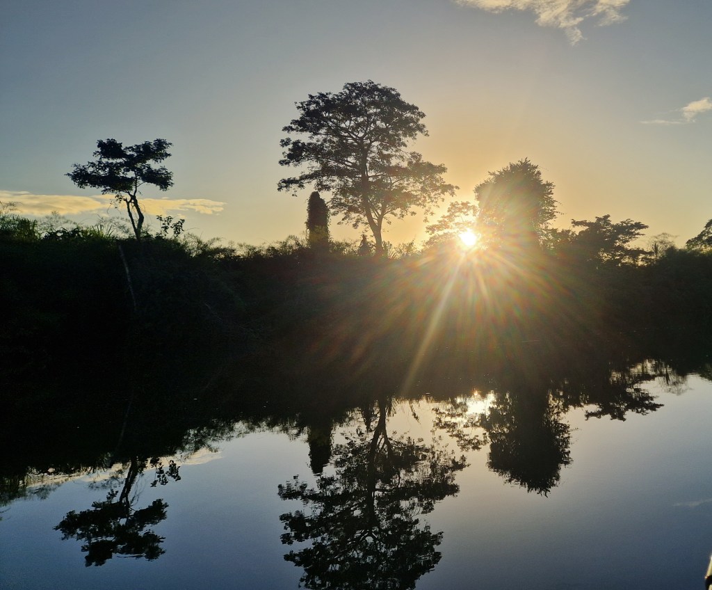
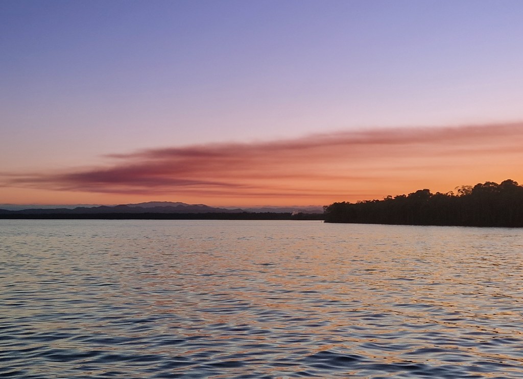
The Temash once again widened into open ocean. We turned southwards, the sun dazzled our eyes as we scanned the shore for a patch of sand and two good trees to which we might fasten our hammocks for the evening. The water was rippling gold, bathed as it was in the evening light, the shadow of shoreline trees gradually creeping out to occupy the surf as the sun set behind the twisting mass of the national park. Beauty in abundance, then, but tough going; each frustrating stroke hardly deep enough to drive us before we hit the sand with the tip of our paddles, we expected the ocean bed to fall away with every effort. But time elapsed, and no change was palpable. Progress at a standstill, we began to simply pull our canoe through the knee-deep waves. We became aware, now, that the light was fading fast, and with it the fruits of our ambition.
An uneasy night in the mangroves loomed; hammocks strung awkwardly between densely packed trunks, branches pressing in on all sides, with no firm ground beneath. Thick mangrove sludge lined the coast, and every attempt to reach even that poorly suited refuge ended with us sinking swiftly into the rank mire. Cursing our lack of research, we turned our minds to the collection of dwellings we had spied on our way upriver, and steered our course north, beyond the point we had exited the Temash.
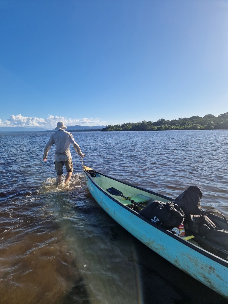
We made rapid ground, hauling our vessel perhaps a mile through the rolling tide before reaching dry land. Our arrival was clearly remarkable; lacking the advantage of contact in the community, we approached the first group we saw, six or seven fishermen gathered under a wooden shelter, stooped over, knives working swiftly to process their daily catch. Their conversation halted as we neared. We might have concealed ourselves from this village, resting in the palms that surrounded its borders, but curiosity drove us in. We asked the fishermen if we could find a shop in the village; met with confused replies of ‘?Espanol?’, we made our petition in that language, and were directed to one of the few wooden structures that lined the shore. We spoke again in hesitant Spanish to the shopkeeper. Her home, like the others, was of sturdy plank-built walls with a tin roof, and a veranda ran the length of the housefront reached by a short staircase. She sat there on a chair, watching us curiously as we stammered over our request to buy her wares. We sat beside her on the bench, settling into silence as we ate and drank.
From this vantage point a process of appraisal took place in our minds, trying to come to terms with the village we now found ourselves in. In front was a short stretch of land that abruptly fell into sea; brightly-coloured fishing boats bobbed in the lapping tide, one tied in front of each dwelling. The village stretched back no further than the length of a single house; in lieu of land, the river mouth and ocean seemed to stretch out like an extension of the village, a large communal garden of sorts, not used simply for a single activity so much as for the space that it was necessary for a community to inhabit. Still, through the scattered palms to our left, children had found just enough ground to play football on the sandy soil.
The shopkeeper was kind. We were offered food, and when the hammering Caribbean rain proved too much for our fly sheets, she insisted that we string our hammocks up in the porch for the night. Wet through and shivering, we were extremely grateful.
Notwithstanding our dry camp, very little sleep came, and we set off for home early the next day. But not without pondering the small settlement; despite a good understanding of the area, we had never heard of its existence. A map we had placed it as ‘Boyo Creek’, a reference to a nearby water source. Further research identified its most common name as ‘Temash Bar’. Still, this was insufficient to understand the processes of its creation, demography, or history. All that could be certain were that these people were of Guatemalan origin, the obvious linguistic clue proving our most valuable.
Publication has referenced this community, some 20 years ago – it was excised from the national park, probably to avoid difficult decisions surrounding its governance thereof. At the time, it was considered incipient; perhaps it is not much older than these records, then. There is a distinct distaste for the settlement in these documents, particularly around the fear of environmental disruption. If these fears were realised, they have been ignored in recent years – along with the village.
Our perception, limited as it may have been, was one of kindness, and a tranquillity deserving of, indeed perhaps determined by, its lack of recognition on even the local scale.
Doubtless far more knowledge about the Temash resides within the communities themselves than can be uncovered from publications. In our experience, this knowledge exists quietly in the rhythms of daily life, embedded in interactions with the river and surrounding forest; difficult to articulate to outsiders, and rarely, if ever, captured in writing. These communities, distinct in their past and present ways of life, are yet bound by the river that flows through them. In this sense, the journey upriver seemed to us to represent a microcosm of modern Belize itself – layers of history, language, and culture, woven through a landscape of supposed wilderness that many call home.


Leave a Reply